Typhoon™

The Typhoon™ data acquisition system is one of the most accurate and powerful geophysical survey technologies available to mineral explorers today.
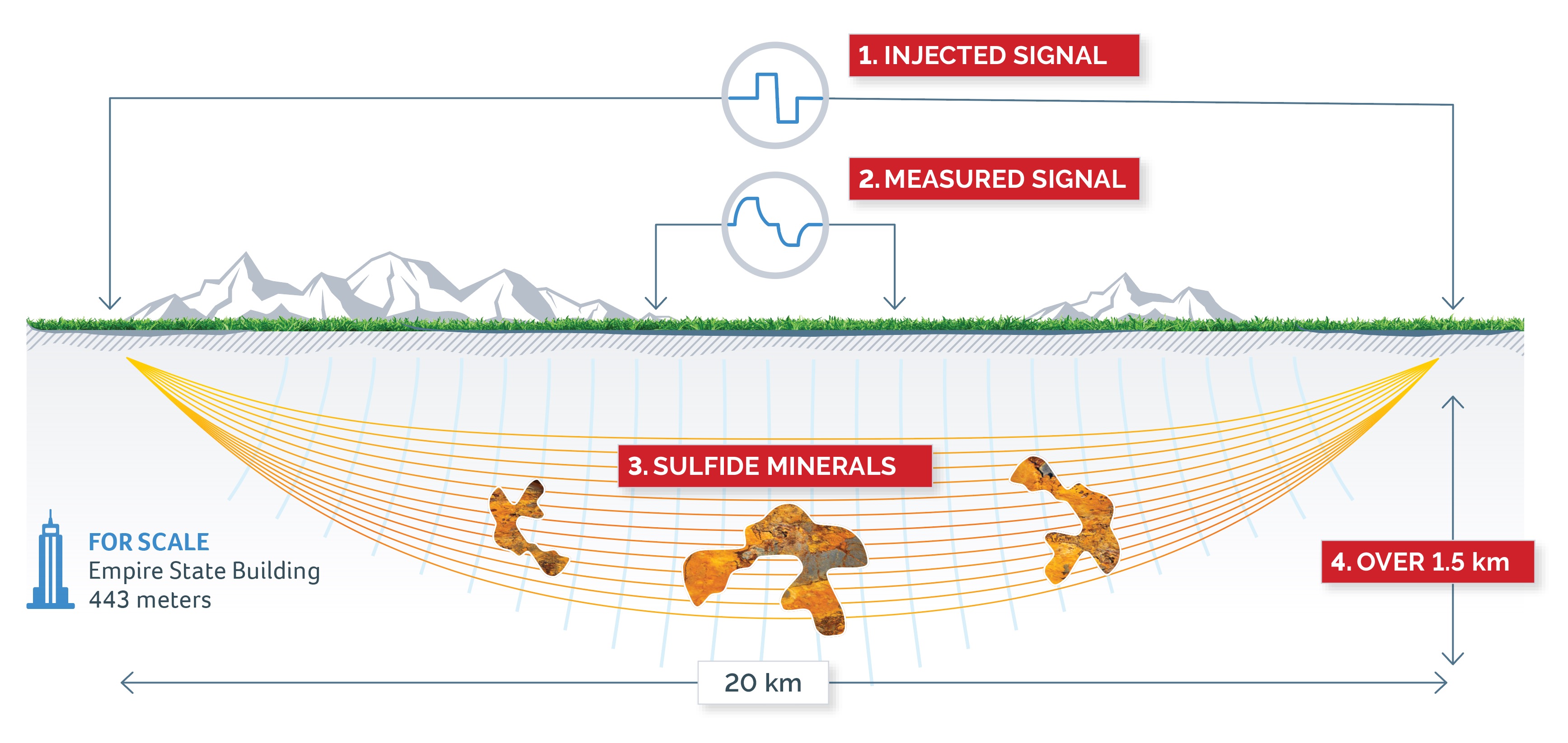
Typhoon™ detects the presence of sulfide minerals containing copper, nickel, gold and silver, at depths of over 1.5 kilometers.
Typhoon™ successfully accelerates and de-risks the exploration process by
enabling resource discovery while lowering exploration costs.
Typhoon™ allows us to potentially discover deposits otherwise thought to be undetectable through conventional survey methods and technology.
1

2

3
4
Greater depth penetration
Typhoon™ uses a precisely controlled signal to provide a very high signal-to-noise ratio, for greater depth penetration – up to five times deeper than other equipment. Our ability to precisely control and tune the waveform allows both time domain and frequency domain induced polarization (IP) and electromagnetic (EM) data to be acquired.
Fast surveys, tough conditions
The immense power of Typhoon™ means large areas can be covered quickly, reducing the cost per unit area. The increased power and better signal also mean less time preparing the ground and electrodes.
Typhoon™ can survey where other systems are ineffective. The high-quality signal produced remains pure even in difficult recording conditions and is especially effective at injecting current into areas of very high contact resistance.
Better processing
The clean, high-quality signal obtained by Typhoon™ must be maintained throughout data processing.
Ivanhoe Electric uses Computational Geosciences’ custom software and advanced IP processing methods to preserve the quality of the signal. This allows us to define subtle targets at greater depths.
Safe, efficient, reliable
The system is available in various configurations making it suitable for diverse exploration environments. On-board intelligent electronics instantly shut down the system if potentially hazardous situations are detected.
Worldwide Deployments
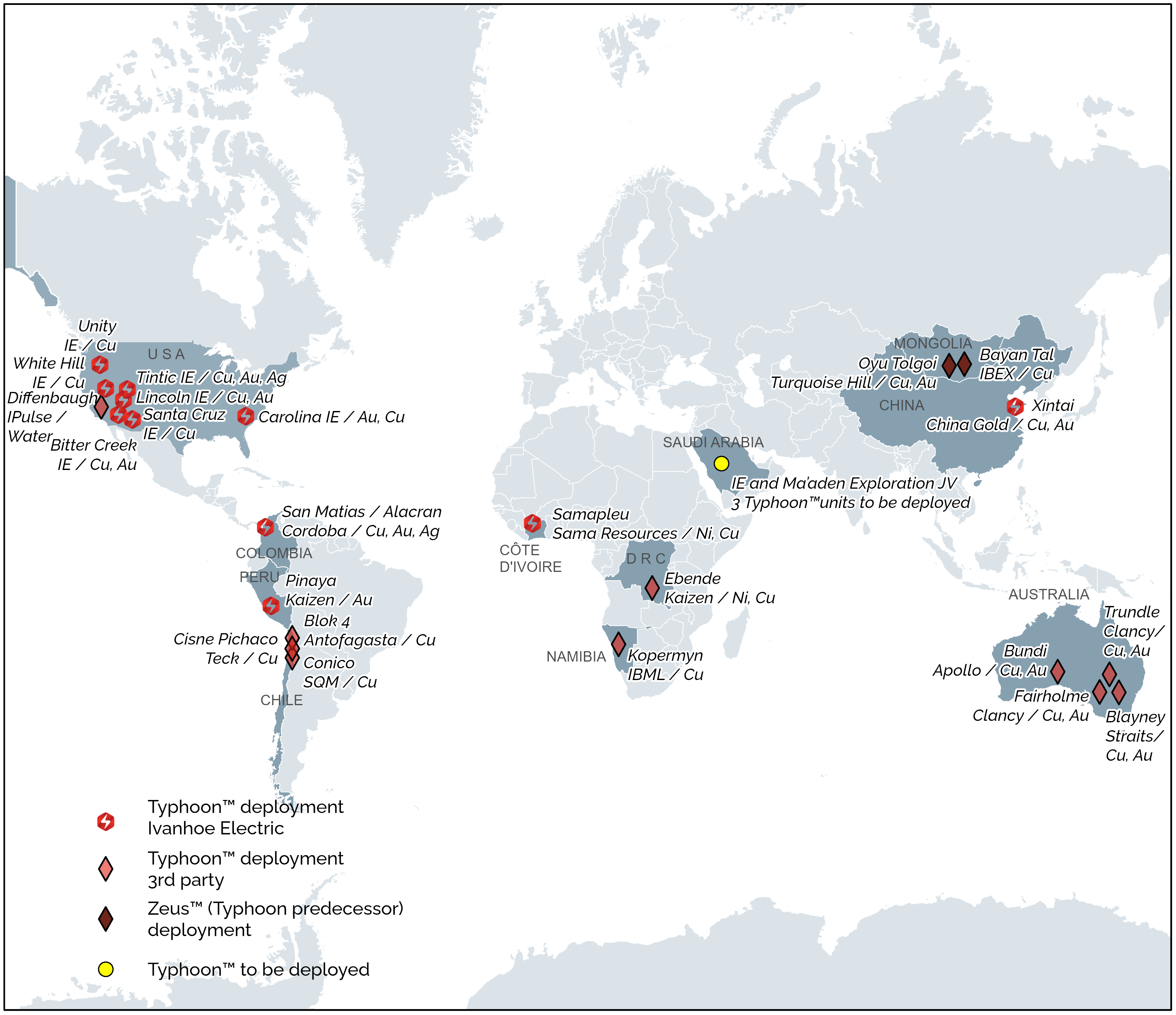
- Typhoon™ has been used to successfully accelerate and de-risk the exploration process by enabling resource discovery while lowering exploration costs.
- Typhoon™ completed a 72 km2 fully 3D induced polarization survey of Tintic, with effective penetration depths averaging 1.5 km.
- Deployment of Typhoon™ at the Santa Cruz Copper Project helped to identify new mineralized targets, allowing Ivanhoe Electric to more efficiently explore with targeted diamond drilling.
- CGI interprets and visualizes the geological data generated by Typhoon™.
Note: In 2009, Typhoon™ predecessor (Zeus™) demonstrated a step change improvement over other available electrical surveys.
Check out our data analytics Computational Geosciences
